VOICE ONE:
I’m Steve Ember.
VOICE TWO:
And I’m Barbara Klein with Explorations in VOA Special English. We received a special request in a letter from a listener in Nagano, Japan. Atsumi Shimoda asked for a report about what the Special English writers thought were the seven natural wonders of the United States.
(MUSIC)
VOICE ONE:
So now we will visit these natural wonders. Some are huge. Some are powerful. And some are even a little frightening! But, we will keep a safe distance. The first stop is a natural wonder that the United States shares with Canada.
(SOUND)
 |
| Niagara Falls |
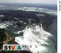
That thundering crash is the tens of thousands of cubic feet of water that flow each second over Niagara Falls which includes the American Falls and Horseshoe Falls. The American Falls in New York State extends more than three hundred twenty meters across part of the Niagara River. The American Falls is more than fifty meters high.
Canada owns the larger Horseshoe Falls. It is about eight hundred meters wide and almost fifty meters high. It is shaped like the letter U, or a horse’s shoe.
VOICE TWO:
Niagara Falls formed about twelve thousand years ago when huge melting sheets of ice formed the Great Lakes. The land was uneven with several drops in level, some very sharp. Water from Lake Erie began to flow north to Lake Ontario as a result of the loss of the ice barrier.
In modern times, several people have gone over Niagara Falls, most of them on purpose. Most also survived. But, we think the beauty and power of Niagara Falls is best experienced from near the water, not in it.
Now we travel southeast to the state of Florida. We will visit the area once called “the liquid heart” of that state — the Everglades.
(MUSIC)
VOICE ONE:
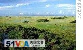
Hundreds of birds fly in a sunny blue sky. The only sounds are bird calls and the soft noise made by tall grasses as the water slowly moves them. Hidden in the grasses, dark green alligators move at the edge of the water, like part of the Earth come alive.
 |
| The Everglades |
This is the Everglades — a low, watery, partly coastal area that covers ten thousand square kilometers. The area is filled with sawgrass. This plant grows in sharp, thin pieces that are three to ten meters tall. The Everglades is sometimes called “river of grass.”
The area also contains forests of palm, cypress, mangrove and pine. And beautiful plants and sweet-smelling flowers grow in the Everglades. These include several kinds of the highly prized and rare flower, the orchid. Animal species are plentiful. Many colorful birds and butterflies live here. So do snakes, foxes, frogs and even big cats, called Florida panthers. But the Everglades alligators and crocodiles are probably the animals most identified with the Everglades. No other place in the world is home to both.
(MUSIC)
VOICE TWO:
Now we travel to the north central part of the country. We are in the state of South Dakota. The land is big and mostly flat with many fields of corn, wheat and soybeans. But as we travel west, the cropland gives way to wild grasses. A strong dry wind blows continuously from the west.
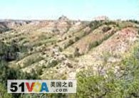
Suddenly, the land becomes torn and rocky, dry and dusty — no longer green and gold. It is now a light red-brown color. All around are broken disordered forms. There are hills and valleys of all sizes and strange shapes.
VOICE ONE:
 |
| The Badlands also extend into North Dakota |
These are the Badlands. Hundreds of thousands of years ago the area was grassland. But, then, forces of nature destroyed the grass. Water and ice cut into the surface of the Earth. They beat at the rocks, wearing them away. The result is one of the world’s strangest sights.
All together, the Badlands cover more than fifteen thousand square kilometers. About ten percent is national parkland. The area is a study in extremes. Temperatures in the summer have been as high as forty-six degrees Celsius. In the winter they have dropped to as low as forty-one degrees below zero. Life in the Badlands is difficult. But animals do survive. The most well known is the prairie dog. This small mammal lives in a series of underground passages.
(MUSIC)
VOICE TWO:
 |
| The Grand Canyon |
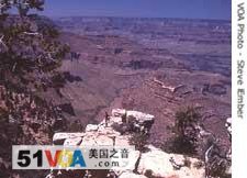
As we continue west we also take a sharp dive south. We want to see the huge hole in the Earth, called the Grand Canyon in the state of Arizona. The first sight is breathtaking. The Grand Canyon stretches for hundreds of kilometers before us and hundreds of meters below us. It is about twenty-four kilometers across at its widest point. Its deepest point is almost two thousand meters down.
The Grand Canyon is a series of deep long cuts in rock. There are many passages and large raised areas. There are forests on the top level and desert areas down below. They provide support for several different ecosystems. The Colorado River flows through the Grand Canyon. The Canyon offers a lot of information about the physical history of Earth. There is a huge amount of fossil evidence. And its walls provide a record of three of the four major periods of the Earth’s geologic time.
(MUSIC)
VOICE ONE:
Now, we are at the hottest, driest and lowest place in North America. Death Valley is part of the Mojave Desert. It lies mostly in the western state of California although part of it reaches into Nevada.
An area called Badwater sits about eighty-six meters below sea level. There is not really any water there. The area gets fewer than five centimeters of rain a year.
During the summer the temperature in Death Valley can reach fifty-seven degrees Celsius. But, it can be dangerously cold in the winter there, too. And storms in the mountains can produce sudden flooding on the valley floor.
In other words, Death Valley is an unforgiving place. The heat has killed people in the past. And it will continue to kill those who are not careful in dealing with the area’s extreme climate.
Death Valley holds much evidence of nature’s past violence. For example, there is Ubehebe Crater. This hole is about one kilometer across and more than two hundred thirty meters deep. It is the remains of a major volcanic explosion about two thousand years ago.
(MUSIC)
VOICE TWO:

Now it is time to cool off in the far northern state of Alaska. We could probably just call all of Alaska a natural wonder. But of special interest are its glaciers. These huge, slow-moving masses of ice cover about seventy-five thousand square kilometers.
About one hundred thousand of these rivers of ice flow down mountains. Some start from thousands of meters up a mountain. They can flow to areas just a few hundred meters above sea level. The largest Alaskan glacier is called Malaspina. It is more than two thousand two hundred square kilometers.
VOICE ONE:
Most glaciers move very slowly. But sometimes one will suddenly speed ahead for a year or two. These are called surge-glaciers. The most recent surges were in two thousand. The Tokositna glacier and Yanert Glaciers now have deep, narrow cuts on their formerly smooth surfaces. Yanert Glacier dropped ninety-one meters as a result of the surge. It is always very cold on the glaciers. Next we go to a hot spot. Sometimes very hot.
(MUSIC)
VOICE TWO:
Welcome to Mount Kilauea, the world’s most active volcano. It is on the island of Hawaii. Kilauea is not far from Mauna Loa, the largest volcano in the world.
Kilauea has been releasing burning hot liquid rock called lava continuously since nineteen eighty-three. The lava flows down the mountain to the Pacific Ocean. Its fierce heat produces a big cloud of steam when it hits the cold water. Kilauean lava continues to add land to the island. Sometimes visitors are able to walk out near the edge of this new black volcanic rock.
VOICE ONE:
These seven natural American wonders, from waterfalls to volcanoes, are not the only ones in the United States. What about the Great Salt Lake, the Old Faithful Geyser, the Mammoth Cave and the giant redwood forests? We will have to report about them and other natural wonders another time.
(MUSIC)
VOICE TWO:
This program was written and produced by Caty Weaver. I’m Barbara Klein.
VOICE ONE:
And I’m Steve Ember. Join us again next week for another EXPLORATIONS in VOA Special English.