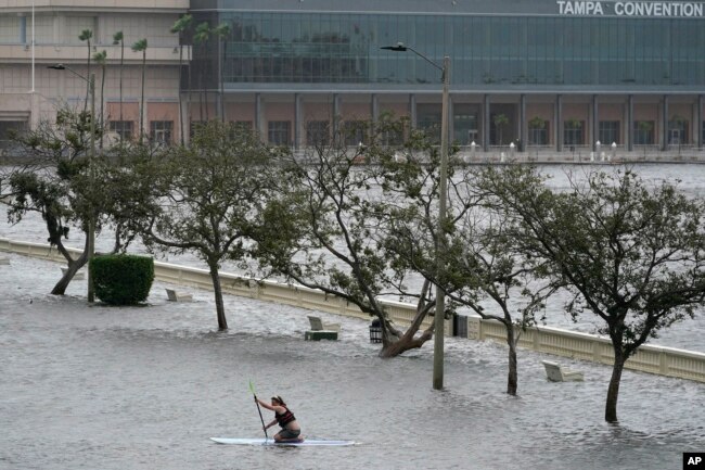
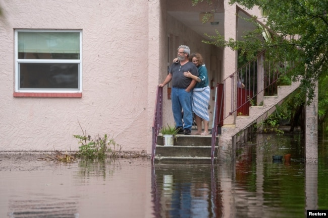
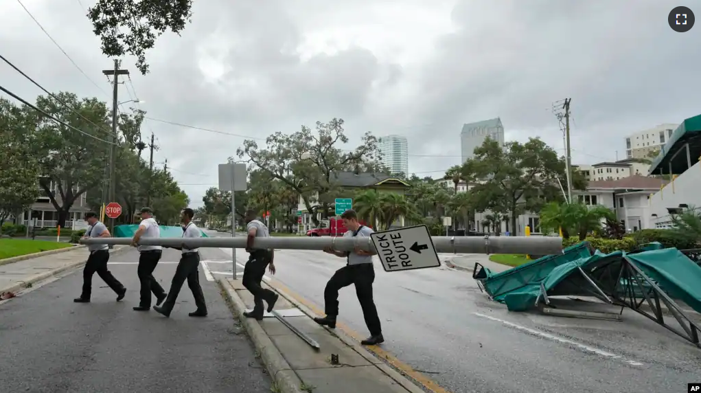
Hurricane Idalia made landfall on the west coast of the American state of Florida on Wednesday. Officials said the dangerous storm brought life-threatening storm surges and flooding to the area.
By early Wednesday morning, more than 200,000 people reportedly were without electricity as strong winds brought down trees and power lines. Along the coast, some homes were underwater, and structures were crushed in the storm surge.
“We have multiple trees down, debris in the roads, do not come,” emergency officials in Cedar Key said. They said most of the streets around the downtown area were underwater.
Idalia landed in a lightly populated area near Keaton Beach at 11:45 UTC. The Category 3 hurricane came with sustained wind speeds as high as 205 kilometers per hour. The National Weather Service places hurricanes into five groups depending on wind speed. The strongest level, a Category 5 hurricane, can reach sustained wind speeds of 252 kilometers an hour or higher.
People who live along Florida’s northwest coast had been ordered to leave the area before Idalia’s arrival. On Wednesday morning, Governor Ron DeSantis told those who have not left to stay inside until the storm passes. He said, “Don’t put your life at risk.”

A full moon could raise tides higher
As the hurricane continues, a rare full moon, called a supermoon, could cause tides to rise higher than normal along Florida’s coast.
When the moon is full, the sun and the moon are pulling in the same direction. This has the effect of increasing tides above normal, said Kerry Emanuel. He is an atmospheric scientist at the Massachusetts Institute of Technology.
The moon’s gravitational pull is stronger when it is closer to the Earth, so the tides could be higher. Wednesday’s supermoon is the closest to the Earth this year.
Brian Haines is head of the National Weather Service office in Charleston, South Carolina. He said, “I would say the timing is pretty bad for this one.”
The storm surge is often the most dangerous event when a hurricane strikes. The National Hurricane Center estimated on Tuesday that ocean water levels could increase by 4.6 meters along parts of Florida’s west coast. Farther south, a storm surge of up to 2.1 meters is expected in the Tampa Bay area.
Hurricanes get their energy from warm water. Idalia is feeding from warm water around Florida.
Colorado State University hurricane researcher Phil Klotzbach called the water temperature of 31-32 degrees “rocket fuel for the storm.” He added, “It’s basically all systems go for the storm to intensify.”

The National Weather Service in Tallahassee called Idalia “an unprecedented event” since no major hurricanes on record have ever passed through the area around Big Bend. The state of Florida, however, is still dealing with damage from Ian, a Category 5 hurricane, last year. Ian was responsible for almost 150 deaths and damaged 52,000 structures.
The National Oceanic and Atmospheric Administration recently said the 2023 hurricane season would be far more active because of extremely warm ocean temperatures. The season runs through November, with most storms taking place in August and September.
I’m Mario Ritter Jr.
Hai Do adapted this report for VOA Learning English from Associated Press sources.
____________________________________________________
Words in This Story
landfall –n. the act of reaching land after a long trip at sea
storm surge –n. an event in which high winds force water from the sea onto the land
debris –n. wreckage and broken pieces of things
sustained –adj. continuing for a period of time
tide –n. the regular upward and downward movement of sea levels in places caused by the moon and other influences
unprecedented –adj. describing something that has never happened before
